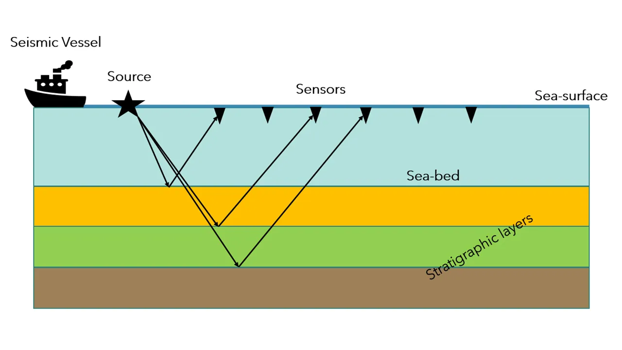
eismic image gives a structural snapshot of the Earth’s subsurface at a time. A sound wave is sent to the subsurface from a ‘source’, which travels through the Earth’s layer at different velocity and gets reflected, refracted or diffracted along its way. In seismic imaging, we record the waves that are reflected back from different geological layers and stack them to create a 2D or 3D image. Because different geological layers have different physical properties, at the boundary between layers, the waves are reflected due to density contrast. There are different kinds of waves, but in imaging we are mostly focused on P-waves (compressional waves). The cartoon below gives you an example of seismic acquisition and actual image after collecting all the waves.
So whose fault is it?
Faults are geological structures created by a combination of numerous physical processes such as pressures, gravity, plate tectonics etc. These are the cracks or planes along which block of rocks slips across. Faults comes in all kind of sizes, from few meters to miles. The _San Andreas Fault _is an example of very large scale strike-slip faulting (also called Transform Fault). There are three major types of faults as shown in below:
- Significance of Fault Mapping in seismic data
- Fault Mapping and Prediction
- Data Exploration
- Deep Convolution Network
- Training Data
- Model Training
- Result
Summary
#python #seismic #machine-learning #deep-learning