Introduction
In this tutorial we’ll be showing you how to get started with Arlula and order your first Landsat 8 satellite imagery datasets for free using our API.

The Arlula API allows users to query databases of satellite imagery from vendors around the world. This powerful tool allows users to search and compare the quality of global image datasets and order them at scale. The Arlula API is a new way in which people from around the world can access timely satellite imagery and create their own data streams from space!
Step 1: Signup
If you’re new to Arlula, you’ll need to create an account, this is a fairly simple process that should only take a few minutes.
Visit https://api.arlula.com/signup and create an account.

Once you signup you’ll receive an email from us, if you cannot find it make sure to check your spam folder!
Step 2: Generate your API credentials
Once you’ve created your account and logged into the Arlula platform you’ll need to create generate new API credentials so you can interact with our infrastructure. If you’re logging in for the first time, you’ll be prompted to generate your first API credentials, where a new window will pop up.
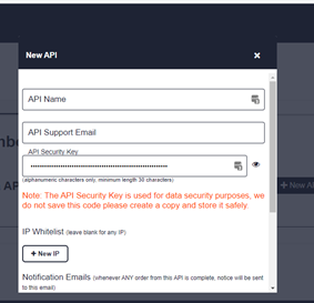
The three main fields that you’ll need to fill out in order to generate new API credentials are **API Name, API Support Email **and **API Security Key. **Your 30 character long API security key is different to your Arlula account password and will be used to securely send encrypted API requests over the web.
**DO NOT FORGET YOUR API SECRET! **A good idea is to save it offline somewhere safely as you’ll need this later.
Once you’ve created your credentials a new page will open to the Arlula API documentation page. If you need to check your API key, or update your secret you can always do this by heading to the details section of your API credentials.
Step 3: Postman Install
Now that we’ve created our Arlula accounts and API credentials we can start making requests to the API. A great 3rd party tool that we use at Arlula for testing and evaluating APIs is called Postman. We’ll be using Postman today in order to make our first requests.
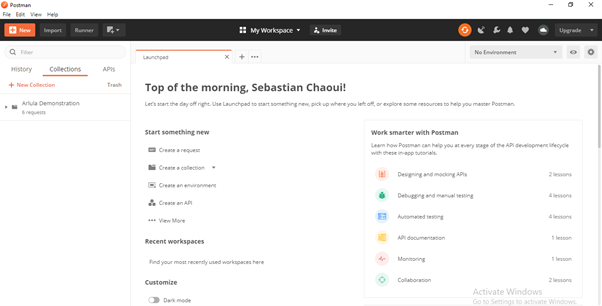
Start by visiting https://www.postman.com/downloads/ and downloading the software to your computer. Once the software is installed and opened, you’ll see something similar to this.
Step 4: Search Imagery Archives
Now we’re ready to start making API requests. The Arlula API has a variety of **GET **and **POST **requests that can be made to perform different tasks.
- Search, for obtaining a list of satellite imagery available for the request’s search criteria
- Orders, for requesting purchase of imagery and its associated data that will be delivered to the provided contact. This is broken down into:
- New order, which creates a new order, and pays for purchasing imagery
- List orders, which will list all past and current orders on your account
- Get order, which will list the details and any associated resources of an order on your account
- Get resource, which requests download of a resource associated with an order, such as the imagery or its metadata
Begin by clicking on the “Collections” tab and create a new collection. Feel free to give it whatever name you like.
Next, we’re going to use the Search endpoint in order to find the latest imagery over Sydney, Australia. Click the “+ New” button in the top left corner of the Postman screen and select “Request”. Give it the name “Get” and then press the Save button (making sure it’s saved to the Collection we just made).
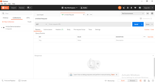
Click on the “Authorization” button and select “Basic Auth” from the drop down menu. Once you’ve selected these features, you’re now able to enter your API key for the “Username” field, and your API Secret for the “Password” field.

Now that we’ve entered the authorization details we’ll be able to conduct a search request. You can conduct a search with the Arlula API based on 3 different search criteria.
- **Time: **Start and end dates (YYYY-MM-DD)
- Image Resolution: vhigh(<0.5m), high(0.5m-1m), med(1m-5m), low(5m-20m), vlow(>20m)
- **Location: **Point search or bounding box
By utilising this search criteria you can find satellite imagery captured on different dates at different resolutions and in different locations all over the world.
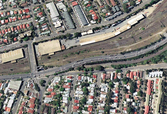
We’ll be using an endpoint to search for low resolution imagery over Sydney between 3/1/2019 and 13/4/2019. Copy the below endpoint into the address bar at the top of the tab.
https://api.arlula.com/api/search?start=2019-01-03&end=2019-04-13&res=low&lat=-33.8523&long=151.2108

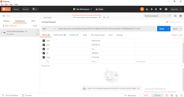
Once you’ve copied in the above HIT SEND!
Congratulations, you’ve just searched through millions of available satellite images in archives around the world.
#remote-sensing #data-science #api #data #gis