This post is inspired by The Beautiful Hidden Logic of Cities and The Beautiful Hidden Logic of Cities –Worldwide. Mapping street designations can reveal some interesting insights. Like how the western half of San Francisco is made up of avenues and the eastern of streets. Or how streets are found only inside London’s historic downtown while roads run outside. I will create a similar map for my own city of Moscow using GeoPandas and Matplotlib and see what we can uncover.
I’ll start with the results; technical details follow and the source Jupyter Notebook can be found on Github.
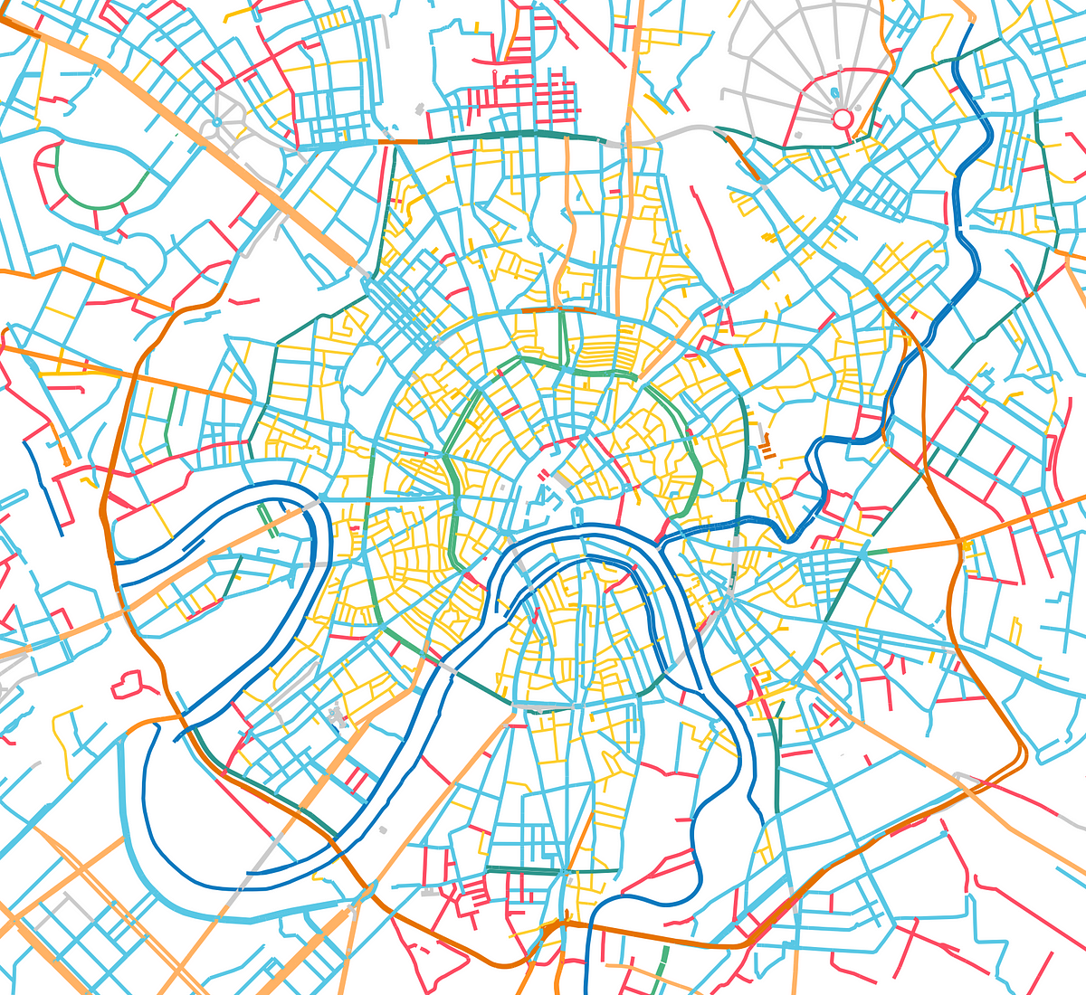
Sidenote on Russian street designations
In Russian, street designations can precede the name (улица Пестеля) or follow the name (Малая Грузинская улица) or even come in the middle if the street has a number (1-я улица Энтузиастов). Using common sense and listing all prefixes and postfixes led to the following list of street designations:
улица [ulitsa] — street
шоссе [shosse] — highway
проезд [proezd] — drive
проспект [prospekt] — avenue
переулок [pereulok] — lane
бульвар [bulvar] — boulevard
площадь [ploshad] — square
набережная [naberezhnaya] — embankment
тупик [tupik] — close
вал [val] — rampart
магистраль [magistral] — motorway
#maps #moscow #urban-planning #data-science #data analysis