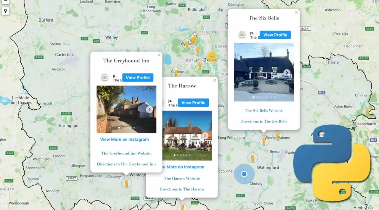
One of my weekend pursuits is to visit all the pubs in my local area of Oxfordshire in the UK. Over time, these numerous pub visits have turned into a popular ‘Pubs of Oxfordshire’ Instagram page. So it was a real shame when, in 2016, Instagram decided to remove its ‘Photo Map’ feature. The reasoning was that most users weren’t actually using it. But what if your account could make good use of such a feature? Any travel, tourist or local blogging page could certainly benefit from it. I’ve spent many hours fumbling with Google’s customised, and rather clumsy, ‘My Maps’ feature, but the results never looked good, and it wasn’t possible to integrate Instagram posts in any way. Well…, as with many other data and web-related tasks, Python has an answer.
What you’ll need
Python has a vast ocean of libraries for different tasks, and when it comes to making beautiful, interactive maps quickly, the Folium library does the job very well. The good news is you don’t need to know much Python to get this working, as I’ll take you through it step-by-step.
Let’s go ahead and import Folium and the other dependencies we’ll need (these will be explained as we encounter them).
#maps #instagram #folium #interactive-maps #python