In Death and Life of Great American Cities, the great Jane Jacobs lays out four essential characteristics of a great neighborhood:
- Density
- A mix of uses
- A mix of building ages, types and conditions
- A street network of short, connected blocks
Of course, she goes into much greater detail on all of these, but I’m not going to get into all the eyes-on-the-street level stuff. Instead, I’m going to find neighborhoods with the right “bones” to build great urbanism onto. The caveat to this, as with most geospatial planning tools, is that it is not to be blindly trusted. There are a lot of details that need on the ground attention.
On to the data.
Tools
For this project, I’m going to use the following import statement:
To start a session with the Census API, you need to give it a key (get one here). I’m also going to start up my OSM tools, define a couple projections, and create some dictionaries for the locations I’m interested in, for convenience:
These two are interesting because they have both seen significant post-war growth and have a broad spectrum of development patterns. As a former Boise resident, I know Ada County well, and can provide on-the-ground insights. King County has a robust data platform that will allow for a different set of insights in part II of this analysis.
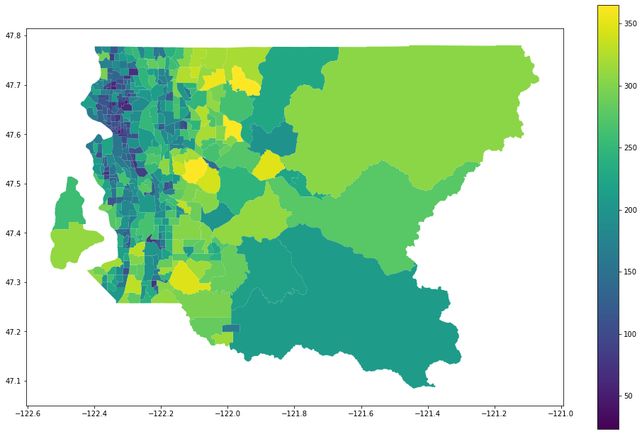
Density
We’ll start off easy. The U.S. Census Bureau publishes population estimates regularly, so we just need to put those to some geometry and see how many people live in different areas. The smallest geography available for all the data that I’m going to use is the tract, so that’s what we’ll get.
#urban-planning #pandas #geopandas #jane-jacobs #python