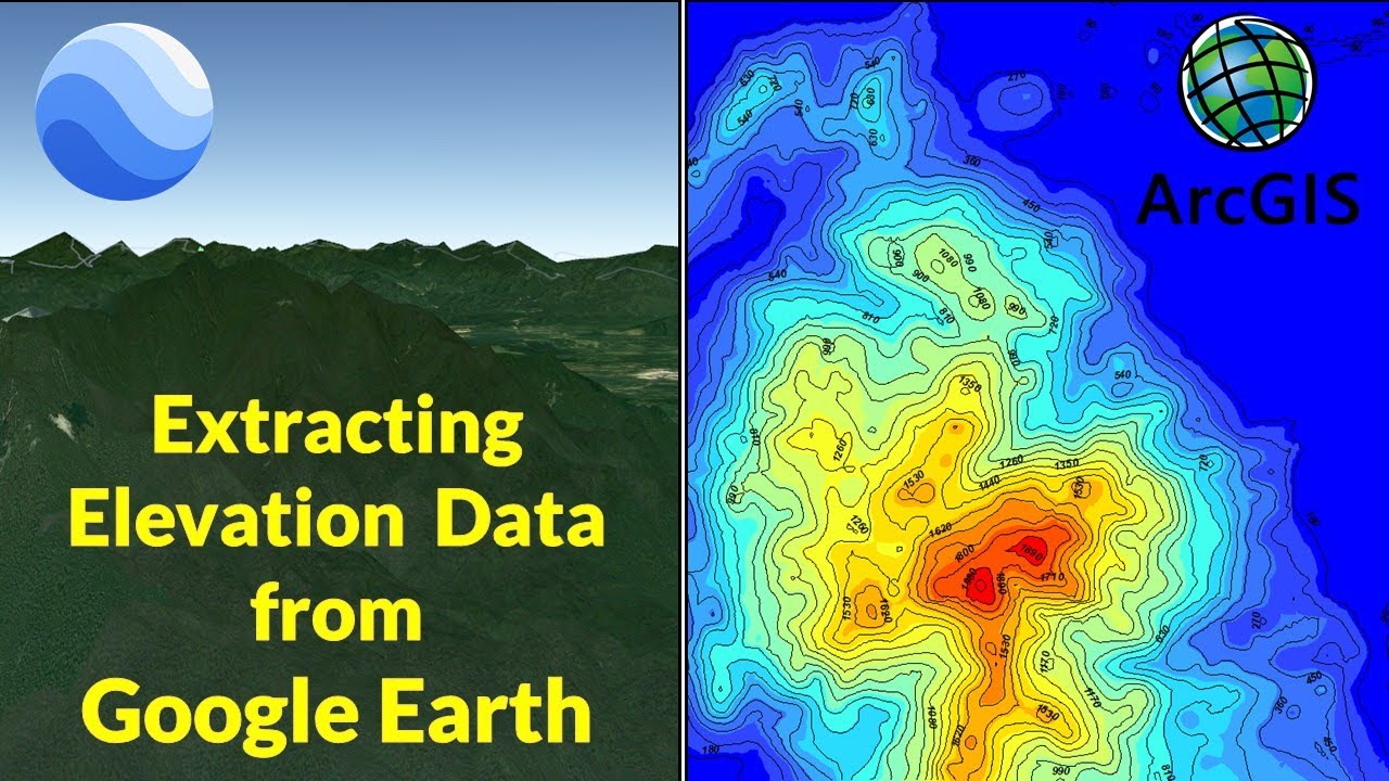
In this tutorial, you will learn how to extract elevation information from Google Earth into a GIS software such as ArcGIS, and how to generate a DEM. The tutorial also shows how to use interpolation methods such as Kriging interpolation to generate the DEM and how to generate contour lines using ArcMap.
GPS Visualizer - https://www.gpsvisualizer.com/elevation
Subscribe: https://www.youtube.com/c/GeoDeltaLabs/featured
#arcgis #arcmap
3.35 GEEK