For many years now, my experience as a GIS and remote sensing specialist has been marked by projects in the **humanitarian sector: **the UN, World Bank, Red Cross, WRI, Translators without Borders; you name it, I probably did some work for them. Back in 2018, when I worked for Urban Resilience Platform — a French startup dedicated to developing software for solid waste management in humanitarian crises — , we were given a very simple but hard to accomplish task: help UNDP and the Turkish government identify every illegal dumpsite in Turkey.
But why, though?
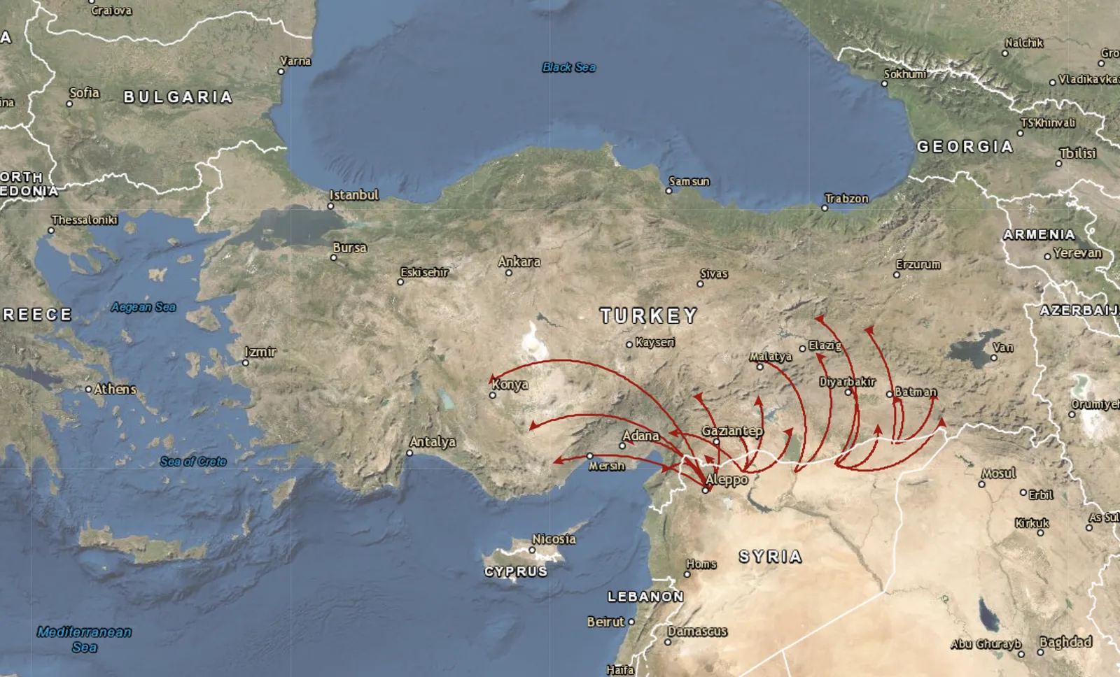
Turkey’s unique geographic position with a 911 Km border with Syria, and its standing as a land migration route to Europe has resulted in the country receiving a large influx of Syrian refugees. Since the beginning of the Syrian crisis in 2016, millions have fled across the border to the Southeastern Anatolia region in Turkey. In July 2018, the number of registered Syrians in Southeastern Anatolia was over 3,5 million.
Migration flows into provinces with highest number of Syrians in Turkey by 2016. Provinces in the southeast are the ones with the most refugee camps, like Sanliurfa, Gaziantep and Osmaniye.
This has led to rapid change in the demographic structure in several Turkish border cities. In Kilis, for example, the number of Syrian refugees is greater than that of the local population.
#remote-sensing #google-earth-engine #geospatial #data-science #data analysis