Why Semantical models?
In the recent Geo Data Science projects, there are more and more uses of the semantical 3D city models or advanced analysis and visualization tasks in a variety of application domains such as urban planning, indoor/outdoor pedestrian navigation, environmental simulations, cultural heritage, or facility management [1].
One of the most popular data schemas is an OGC CityGML. The CityGML is the global data model schema for describing 3D geo-spatially-enabled urban models; developed by the OGC (open geospatial consortium). CityGML describes urban objects like buildings, roads, bridges, trees, etc. in 3D geographical space. CityGML urban object data attribute classes include Semantics, Geometry, Topology, and Appearance. CityGML is an open, international consensus standard with over fifteen years of cooperative development and use [2].
Example Use case: Environmental Building Energy Simulation/ Analysis
For example, the CityGML-based semantic 3D building model can be used to simulate its heating energy demand over the year. The figures below show our dashboard result from our research lab in HFT Stuttgart computing energy demand in the city of Rotterdam, Ludwigsburg — Germany, and Brooklyn — USA respectively.

Calculated heat demand of the buildings in Rotterdam based on the CityGML models. (Developed and Screenshot by Author)
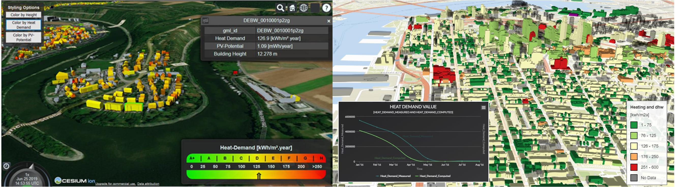
Web 3D visualization of urban energy data for Landkreis Ludwigsburg, Germany (Left) and Brooklyn, USA (Right) [5] (Developed and Screenshot by Author)
Open-Source 3D Semantical Building Models
More and more cities around the world had provided their 3D city models for researchers and developers. However, some of you might not be aware of this existing valuable source of data!
This article includes a list of available official open-source 3D semantical data models I knew of.
#data-science #3d-city-model #3d-building-models #data-visualization #citygml
